Big Bluff

Hike Date – September 22 – 23, 2012

DSCN2618After the last hiking attempt, we opted to head out on a dog-free backpacking trip which means enjoying the wonders of the Buffalo National River.  The weather was perfect, no chance of rain…70’s during the day, 50’s at night.

The hike – Centerpoint Trailhead to Big Bluff, camp by the river, see Granny’s cabin and head back the next day.

The hikers – Shelley, Stuart, and Craig

DSCN2620This particular route is about 4 miles out and back.  The crown jewel is the awesome view from Big Bluff.  There is a trail about 300 feet above the river that hugs the side of the bluff leading to a natural rock shelter that overlooks the Buffalo River.  The view is astounding and the acoustics are amazing.  The only trick is overcoming the elevation change, which is approximately 1,200 feet down and then back up.

DSCN2625
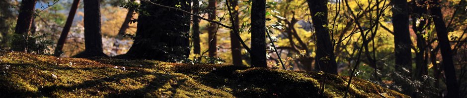
It was not too bad heading down into the river valley.  The grade was steep, but the trail is really an old county road, so there wasn’t much of a chance of getting lost.   We met with several other small groups in the area who were all out to enjoy the beautiful weather.

The trail out to BigBluff is the ‘Goat Trail’.  I don’t believe it’s maintained by the park, but it’s certainly well-used.  It gets a little sketchy in some spots, but I managed to not slide down the bluff.  Since I was minus my little buddy Buster, I was able to stop and get some amazing shots of the river.  The spot where we were is 300 feet above Buffalo River and looks across to Fisher Point.  We could hear horses somewhere, but when they finally appeared, they were tiny dots by the river. 

DSCN2629After spending some time enjoying the view (which included a huge bird making great lazy circles…maybe a hawk?), we headed back up the goat trail and took a right to head down into the river.  The river was extremely low.  We found a great campsite next to a pool of water next to a beautiful bluff.  Normally, I think this spot would be underwater, but it was a good place to set up a tent and check things out.

DSCN2639DSCN2640

DSCN2646Camp was pretty uneventful, the most outstanding (and strange event) happened after the sun finally set, when only the campfire and the moonlight lit the bluff across the river.  No sooner were the words, “I wonder if we’ll see any critters tonight” were uttered when arose a ruckus in the brush behind the tents.  A few tense moments later, a pig walked into camp.  I thought it was an armadillo, encouraged by the frequent suggestion that it must be an armadillo.  Turns out, it was a pig.  Which, after I squealed, “It’s a pig!” and jumped up, it squealed and ran off.  Now, I’ve seen the hog hunter show on t.v., but this pig looked like Babe, not a razorback.  No doubt, one can imagine the excitement that ensued by this unwanted visitor, however I’m happy to report that the pig nor his mother returned to harry us that evening. 

The next day, we ate breakfast (twice), and headed back up the hill.  We stopped on our way out to visit Granny Henderson’s cabin then began the long trudge back up the hill.  We met lots of groups going back up.  We finally made it in a few hours (give or take 45 minutes) and made it home before dark.

See the rest of the pictures here.

Posted in Hiking | Tagged , , , , | 3 Comments

Richland Creek Wilderness


Hike date September 8-9, 2012

Richland Creek Wilderness in the Boston Mountains is managed by the USDA Forest Service.  There is a campground called Richland Creek Campground,  the directions on the USDA Forest Service site are the clearest. 0070  I wouldn’t recommend directions from Google Maps.  Our goal on this backpacking trip was to see Richland Falls, Twin Falls and maybe the Sandcastles.  Alas, it was not meant to be. 

Tim Ernst mentions the Richland Creek Wilderness in both the Arkansas Hiking Trails and and Ozark Highlands Trail books, which are excellent resources for planning a hike.  We decided to start at Hill Cemetery and hike south to Twin Falls.  This is not an easy spot to find.  The USDA Forestry site mentions the road is not recommended for passenger vehicles.  I wouldn’t recommend it at all, the road is veryDSCN2594 rough at two spots and appears to be washed out, at the end, there is very limited parking.  After a scouting mission by Stuart and Dan, the decision was made to back the CRV up and head toward Richland Creek Campgrounds.  Although the universe tried to persuade us on a different course, our dogged determination culminated in a start time of 1:45 p.m, about 3 hours behind schedule. Undaunted we forged ahead into a real wilderness experience.

The backpacking team was comprised of myself, my husband Stuart, our friend Dan, and the doggies, Buster and Katie. There isn’t an official trail in the wilderness area, but we were going to be hiking along an old logging road and I thought DSCN2596the worst thing we would encounter would be a couple of downed trees or brushy areas. I was not prepared for the landslides of house-sized boulders and absence of the trail entirely.  Despite the ruggedness, the area is undeniably beautiful.  The geography reflects the evidence of swiftly eroded V-shaped valleys with a crystal clear creek moving swiftly between boulders.  Our visit is after a long, hot, dry summer, so the creek was very low.  When the water is running, folks go kayaking down the creek.

DSCN2597We started from the trailhead at the end of the lower loop at Richland Creek Campground.  There is a registration box, then you cross Falling Water Creek to get to the old logging road.    Falling Water Creek was completely dry when we were there, leading to some wandering about on my part.  After we crossed the creek, I went up a hill to confirm there was actually a creek on both sides of us (Falling Water was on one side of us and Richland Creek was on the other).  All we really  needed to do to get close to our Twin Falls goal was follow Richland Creek. 

The trail was pretty good in some spots, but then it would entirely disappear.  Some of the landslide damage looked fairly recent.  DSCN2607We tried to stay out of the creek area and on the logging road, but inevitably we would end up at the creek, as the natural inclination is to go down hill.  There were several great spots to stop and view the scenery or take a quick swim in the creek to cool off.  The weather was absolutely beautiful, but it can still get warm when you are carrying a pack.

Around 4 p.m. we came to an old camp site that would do and decided to stop.  We were at the point where Richland Creek turns and not far from Richland Falls and Twin Falls.  It was at this point we found one of our team was down. 

Once Buster made it to camp, he wouldn’t move and started whining.  After an exhaustive examination we were stumped as to what the cause could be DSCN2609and started feeling very guilty about bringing our dogs so far out into the woods.  In fact, the ‘happy to be at camp’ picture features turned out to be me getting ‘the foot’.  It was a long night.  The next morning, we decided to turn around and begin the emergency evacuation.  After going about 10 feet, Buster refused to move so we had to come up with a Plan B.  Dan and I split the load Stuart was carrying and then we put Buster in Stuart’s backpack.  It was a bit harrowing at times because the trail is so narrow and the drop-off so steep, but Stuart managed to carry all 45 pounds of Buster through the wilderness and almost all the way back to the car.  The only time Buster made a sound was when we would stop to take a break, then he would start whining and we would shortly be on our way again.

It turns out Buster had a tick disease that made his joints ache, now…after a week and many pills, Buster is starting to get around again.  The next time we attempt this, I believe a doggy spa weekend may be in order.  I also think we could camp at Richland Creek Campgrounds and get around a lot better.

Check out the rest of the photos here.

VITAL INFO

Trail Name and Location
No official trail.  Near Pelsor, AR

County, State
Newton County, Arkansas

Date Hiked
2011-09-08 2011-09-09

Weather/Conditions
70’s and sunny

Directions
From Richland Campground

Hike Length/Type

Other Permitted Usage
none

Difficulty  (1=Easy; 5=Most Difficult)

5

ATT Cell Coverage?
No

Official Info – Phone/Links

USDA

http://www.fs.usda.gov/recarea/osfnf/recreation/camping-cabins/recarea/?recid=43479&actid=34

Ozark-St. Francis National Forests
605 West Main
Russellville, AR 72801
(479) 964-7200

Posted in Hiking | Tagged , , | 2 Comments

Hemmed-in-Hollow

DSCN2166This past weekend, we headed back to the Buffalo River to see the famed Hemmed-in-Hollow Falls.  We had our friend, Dan,  join us and since there were two cars, we opted to park on at the Compton Trailhead and hike back to the other car at Steel Creek campground, thinking we would avoid the dreadfully steep climb back up to Compton.  To ensure an early start, we camped Friday night at Steel Creek.  I went for a walk back up the road into the DSCN2167camp and got to spend some time watching a doe having a little dinner in the field.  After a rather sleepless night due to the raucous and rowdy behavior of other campers in the park, we were up at 4:30 a.m. decided to grab a bite to eat in Ponca while the tent dried out from the dew condensation.  Wet tents are no fun, but the early morning fog makes a pretty picture.

DSCN2168DSCN2171T

DSCN2172To get to the Compton Trailhead, we went north on 43 from Steel Creek, through Ponca and turned right on County Road 19, which was marked with a sign.  Unfortunately, for the next turn, the sign had fallen down and after a couple of failed attempts, we figured out we were supposed to take a right.  About a mile down the dirt road there is one more right for the trailhead parking.  The hike to the falls is only 2.5 miles, but it’s straight down, most of it on stair-stepped rocks.

The hillside had lots of flowers in bloom and some very cooperative butterflies and I was frequently far behind Stuart and Dan.

DSCN2185DSCN2198

Even though it is now full summer (regardless of what the calendar says), there were still several awesome views through the trees.  During leaf-off, it would be spectacular, but I DSCN2199DSCN2200

DSCN2203DSCN2205

DSCN2210About a mile in, there is a campsite and a trail that leads behind the campsite to a great overlook.  We took the opportunity to stop for a break and enjoy the scenery.  There is an expansive view of the valley below and a really neat limestone bluff in the hillside across the valley.

DSCN2206DSCN2207

Soon, a youth group caught up with us and we pointed them toward the overlook while we scooted down the trail.  A few of them decided not to continue on to the falls, and they missed out!  We met up with the rest of their group again at Hemmed-in-Hollow.

The About 2 miles in, the trail levels out a bit and we passed several large and small groups of hikers making their way back from the falls.  There is a nice little waterfall and creek area just about 1/4 of a mile before Hemmed-in-Hollow and we stopped and explored the area a bit.  A nice couple that was hiking back told us part of the trail was washed out, but still passable and the view was worth it.  That was all the motivation we needed to start back on the trail.  The washed out part of the trail is on the way to the canyon and it is definitely a bit tricky.

DSCN2216Hemmed-in-Hollow was amazing.  It was one of the most spectacular sights I’ve seen while hiking so far.  Pictures really cannot do it justice.  We’d seen pictures and videos, but the real thing is so much more impressive.  Hemmed-in-Hollow is a narrow box canyon with a 209 foot waterfall that has carved a ‘bowl’ in the bottom of the canyon.  The canyon is limestone and the waterfall moves around in the breeze, making where the water fall lands move back and forth across the canyon.  We haven’t had much rain in the past week or so, and the water level was lower, but the falls were still running and moving around.  It was starting to warm up and the first order of business was to stand underneath the cascade and cool off.  We spent about an hour in the canyon watching the falls and checking out the crawdads chasing tadpoles in one of the pools.  We also got to see a water snake that was about 6 inches long swim through the pool and under the rocks. 

DSCN2219DSCN2224

To avoid the hike back up to the trailhead, we took the lower route to the river and planned to camp out that night along the Old River Trail.  The river is about .3 miles from the falls and it did not take us long to get there.  It was about 12:30, so we stopped and took a dip in a great little swimming spot in the river.  The Old River Trail crosses the river 6 times on the way back to Steel Creek, so this made our first river crossing of the trip.  We found some campsites just after crossing the river and made camp and took a little afternoon nap.

DSCN2227DSCN2230

DSCN2231DSCN2232

DSCN2233After we were rested up, we scouted around and found a nice little sandy beach next to a bluff and noticed the thunderstorm brewing.  There was a 20% chance of rain, so we knew there was a possibility we would get wet, but thought that perhaps it would just be a brief afternoon shower.  We were wrong about that.  It started raining about 7 pm and rained until well into the next morning.  The tent did a great job though…I took a picture of the dry spot that remained after packing up the next morning.

DSCN2238It was about 4 miles back to Steel Creek and lots of river crossings, so we headed out.  The rain had turned the Old River Trail into a muddy, mucky mess.  Added to that, we decided to NOT change into water socks and slogged through the creek in our boots.  In hindsight, this was a mistake. Initially, most of the trail was over river rocks, but eventually, it turned into more of a really long mud puddle through the woods.

DSCN2239DSCN2240

DSCN2242The guys were hiking like their hair was on fire, so they managed to walk right past the old foundation of the Centerpoint School.  Fortunately, I was able to snap some pictures so they would know what they missed.

After lots of river crossings and bluff sightings, we wound our way through a wooded area.  A deer spotted me taking a bit of a break and stood still long enough for me to take a picture, although you have to really be looking to find it.

DSCN2276

By the time we made it back to Steel Creek, we were ready for civilization again.  Hemmed-in-Hollow was totally worth the hike, but I wouldn’t recommend the Old River Trail if there has been any rain.  It is level, which is a bonus, but it is also in the river bottom which means it’s the first to get soggy with any precipitation.  If you do hike it…take off your boots for the river crossings.

DSCN2251DSCN2248

Posted in Hiking | Tagged , , , , , , | 4 Comments